On this page
Three key points
The Mercator projection makes areas at high latitudes appear larger.
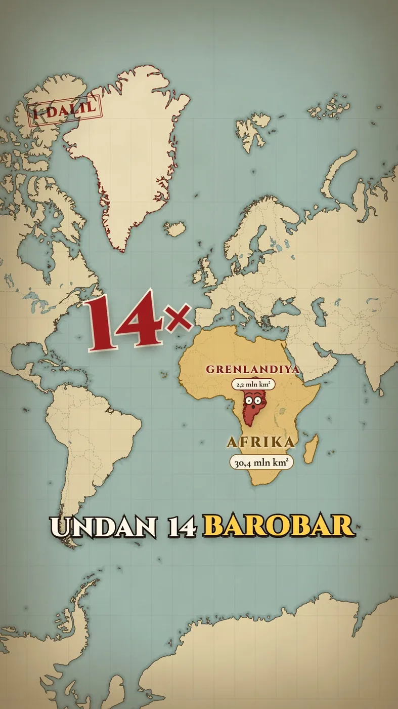
Africa’s actual area is about 14 times Greenland’s.
Moving a country to another latitude is a visual comparison; its real borders and area do not change.
Is the map lying?
A spherical Earth cannot be shown on a flat map without some distortion. Mercator is useful for navigation, but exaggerates areas near the poles.
“The map lies” is a humorous, dramatic title. Mercator is not technically incorrect; it can mislead when used to compare areas.
Africa and Greenland
With Natural Earth boundaries, our calculation makes Africa about 13.9 times Greenland’s area, rounded to “14 times” in everyday speech.
Different boundary and coastline precision changes the figure slightly. The silhouettes in the video use generalized map data.
How large is Uzbekistan?
Using Natural Earth shapes, Uzbekistan and Sweden have nearly equal actual areas. Germany, Japan and the United Kingdom are smaller.
An on-map phrase such as “three times bigger” depends on projection and placement. It is not an official land-area statistic.
Countries moved on the map
We shifted country outlines across the map to show the comparison. No political borders changed.
Moving a silhouette to another latitude does not move the real country. The final map is another projection, not the one uniquely “true” flat map.
About the materials
Natural Earth map geometry. The portrait of Gerard Mercator is based on Frans Hogenberg’s 1574 engraving.
Music
Found an error?
If you find a specific error or a better source, send us the claim and its link. We will review it and date any correction on this page.
Write to us on Instagram